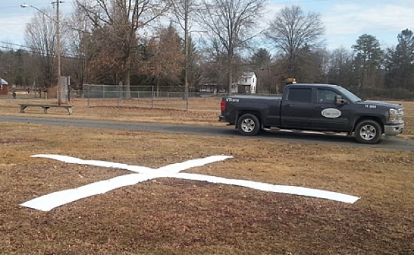
BRATTLEBORO — Have you seen a big white “X” on the ground anywhere in Windham or Bennington County? Have you wondered why it's there?
According to Jeff Nugent, a senior planner with the Windham Regional Commission (WRC), it's all part of an effort this spring to produce new orthophotos, which are used by many people and organizations, including WRC, for mapping and reference.
For WRC's work, orthophotos are nothing short of critical, according to a news release.
Specifically, each white “X” is a target that is placed at a reference point whose coordinates (i.e., its location on the Earth) are known precisely, and with a high degree of accuracy. These targets will be visible on the photos that will be taken from aircraft towards the end of April.
“Having known coordinates on these photos is a necessary part of turning regular aerial photos into orthophotos,” said Nugent.
Orthophotos can be used just like a map, and are the base for much of Vermont's GIS data. Paper versions were first created in 1974 to support tax mapping; today's versions are digital.
Nugent said that this orthophotography should be done when there's no snow on the ground, the leaves haven't yet emerged, and the sky is cloud-free.
“Such perfect conditions rarely exist everywhere across the Windham Region, and this year will be no exception - there's still two feet of snow in Searsburg,” he said.
And so this year's photos, like the ones in 2010, may show some snow and ice at the high elevations.