Vermont officials began assessing damage Tuesday after several inches of rain fell on many parts of the state the day before, flooding towns, closing roads and prompting several rescues.
Following July's devastating floods, the rain caused widespread anxiety as state and local officials watched rivers jump their banks, in some cases flooding businesses and basements. By Tuesday afternoon, most waterways had receded, though many remained swollen.
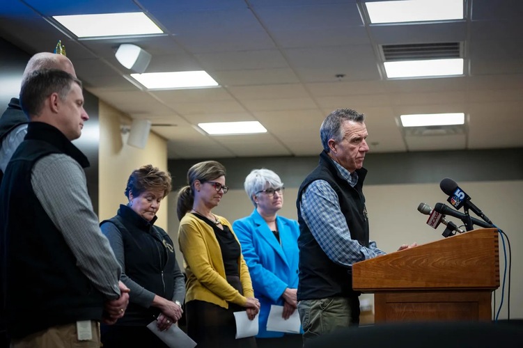
"Some rivers are still at flood stage and most have extremely strong currents," Public Safety Commissioner Jennifer Morrison said at a press conference Tuesday afternoon in Berlin. "Everyone is encouraged to stay clear of floodwaters."
As of Tuesday afternoon, no injuries or deaths had been tied to the event, but the storm caused disruption across the state, closing 40 roads by Monday night and sending students from 120 schools home early on Monday afternoon, according to members of Scott's cabinet.
"Seeing homes and businesses surrounded by water once again has been heartbreaking," Scott said at the Berlin press conference Tuesday. "I feel for those who are just getting back on their feet after this summer's flooding, and they're now dealing with water in their homes and businesses again."
He called for "anyone who is able" to reach out to neighbors and help their communities clean up from yet another flood.
Public safety
Swift-water rescue teams performed 12 rescues around the state on Monday and Tuesday, according to Morrison. One rescue involved removing three people from a house in Jamaica. Nine others involved rescuing people from vehicles caught in floodwaters, including in Lyndonville, Waterbury and Richmond.
While two swift-water teams remained staged early Tuesday afternoon - in Waterbury and Colchester - Morrison said she expected to call off those teams later that day. The State Emergency Operations Center remained activated, and towns could continue to contact the center through their emergency management directors.
While a number of warming shelters had opened in response to the flooding, a shelter in Cavendish was the only one still operating Tuesday afternoon. Morrison directed Vermonters in need of immediate shelter to call 211 and refer to a state webpage listing open shelters.
On Monday night, 18 people stayed at an emergency shelter at the Barre Auditorium organized by the American Red Cross, according to Jennifer Costa, a spokesperson for the Red Cross' Vermont chapter. Such shelters host people who need to evacuate their homes and don't have another safe place to stay, she said.
By Tuesday morning, all 18 residents were able to either return home or find alternative shelter, according to Costa. The Red Cross planned to close the shelter by 4 p.m.
The Red Cross had trained disaster mental health volunteers on hand, Costa said, noting that "this area just went through very similar trauma six months ago."
Morrison also referred residents to guidance from the Vermont Department of Health intended for Vermonters who are returning to flooded homes.
To report damage to their homes, Vermonters can use the 211 website, which will help the state determine whether it has met the threshold to apply for a federal disaster declaration. That would unlock federal money to help manage the aftermath of the disaster.
Scott said Tuesday afternoon that it was "very difficult to tell at this point" whether Monday's flooding would qualify for assistance from the Federal Emergency Management Agency.
"It will be close if it does, but we'll just have to wait and see what the damages are," he said.
Schools closed
The extent of Monday's storm took many education officials by surprise, prompting 120 schools to close early, according to Heather Bouchey, interim secretary of the state Agency of Education. At Tuesday's press conference in Berlin, she called the event a "mass early dismissal."
"I'm quite convinced that our superintendents and our principals did not anticipate when they showed up for a regular Monday that they would then almost literally have to turn around and send kids home," Bouchey said. "They all did it and got kids home safely."
The closures generally resulted from a need to find alternate bus routes after the rains had flooded or closed roads, she said.
On Tuesday, six school districts - including 54 schools - remained fully closed, and more schools delayed opening as officials assessed road conditions, according to Bouchey.
No schools were expected to close on Wednesday, she said, but kindergarten through sixth grade students at Moretown Elementary School will go to Harwood Middle School and High School for the remainder of the week as a result of damage to the elementary school's heating system and to some classrooms.
Infrastructure
While the state Agency of Transportation had only closed 15 state roads by 5 p.m. on Monday, that number rose to 40 by 9 p.m., according to Transportation Secretary Joe Flynn. By Tuesday afternoon, all but seven state roads had reopened.
All railway repairs made after the July floods withstood Monday's storm, Flynn said at the Berlin press conference.
Officials were on the watch for potential landslides. Some slopes began to slide after the storm in July but did not fully collapse. Now, some of those slopes may be threatened, and the state has received several reports of slopes that have already given way. However, Vermont's partially frozen soils are less likely to give way than they would have been at another time of year, Secretary of Natural Resources Julie Moore said at Tuesday's press conference.
Only one slide remained problematic from the perspective of the Agency of Transportation, Flynn said, along Route 2 in St. Johnsbury. Other landslides took place in Wardsboro, Springfield and Chester.
Officials with the Agency of Natural Resources' dam safety team monitored the state's flood control dams "literally throughout the night," Moore said.
"The dams do all continue to perform admirably under this second really significant test this year," she said.
The team also communicated with emergency managers for municipalities and contacted owners of dams considered "high" and "significant" hazards to ask that they assess whether damage had taken place. State engineers planned to visit some of the dams in person to inspect them, Moore said. There was no reported damage to hydroelectric dams.
Municipal drinking water appears to be safe throughout the state, with no "do not drink" or "boil water" notices in place. The state was working with officials from Woodstock, Fairfax and Richmond, all of which received high flows into their drinking water systems, to understand whether problems exist.
Fifteen wastewater treatment plants experienced flood-related problems, including overflows of untreated or partially treated wastewater and combined sewer overflows, "all of which have resolved with receding floodwaters, and without permanent damage or disruption of service," Moore said.
A wastewater treatment facility in Johnson, which was hit hard in July, was flooded Monday, but "the data that was collected this morning indicate that their effluent quality is unaffected," Moore said Tuesday.
In terms of river erosion, Moore said this event was less destructive than the July floods.
"That said, there are engineers on the ground working with the towns of Chester, Ludlow, Wardsboro, Brattleboro, Springfield, Strafford, Jamaica, Randolph, as well as several communities in the Mad River Valley and the greater Montpelier area, to address river-related concerns and damage that's been reported to town-owned culverts," Moore said.
The storm
Originating in the Gulf of Mexico, the storm brought an unusually large amount of moisture to the Northeast, according to Eric Myskowski, a forecaster with the National Weather Service in Burlington. Warm temperatures melted much of the state's existing snowpack, exacerbating the flooding from rainfall, he said.
At a press conference on Monday, Scott said he was surprised by the extent of the storm's damage. Asked Tuesday whether there was more the state could have done to prepare, Scott said there wasn't.
"We'll learn something from this storm," he said.
The governor said there was more rain than he expected, and the snowmelt added to the flooding. The state was dealing with a number of variables at once, and they were playing out differently in different locations.
"Across the state, this seemed like it was much broader geographically than maybe the storm in July, but not as intense, and we didn't suffer the damage," Scott said.
Most of the state's rivers had receded by Tuesday morning, with the exception of the lower Winooski River, which was still at major flood stage at 10:30 a.m., particularly near Essex Junction, according to Eric Myskowski, a forecaster with the National Weather Service in Burlington. The river's waters were expected to recede throughout the day Tuesday.
In several areas across the state, the weather set new records for temperature and rainfall. In Burlington, the minimum temperature of 44 degrees broke the previous record of 39 degrees, set in 1996. At 59 degrees, the temperature in Montpelier on Monday broke the old record of 50 set in 1949.
Burlington has never seen as much rainfall on Dec. 18 as it did on Monday. At 2.2 inches, the city broke its previous record of 0.85 inches, set in 1954.
Myskowski said it's difficult to connect any single event to climate change but said "there's been a higher frequency of heavier rain events during the winter in the last 10 to 15 years."
This News item by Emma Cotton originally appeared in VtDigger and was republished in The Commons with permission.