DUMMERSTON — After quite a bit of work, and a final public hearing the same day, on Sept. 2 the Selectboard approved the town Planning Commission's zoning bylaw.
This vote represents the first major change to zoning districts since 1971, when zoning was established in the town.
The board cast a 4-1 vote, with Selectboard Member Gurudharm Khalsa voting against the proposal.
Sam Farwell, who serves on the Planning Commission, told The Commons in an email, “A substantial Town Plan update in 2010 called for revisions to zoning districts. It was a contentious process getting the town plan adopted.
“Dummerston is no different from other towns: some people don't see the need for zoning at all, and some people see it as the answer for everything. Everybody fears change. we have been diligent in the process, with public forums, and revisions based on comments made at those forums.”
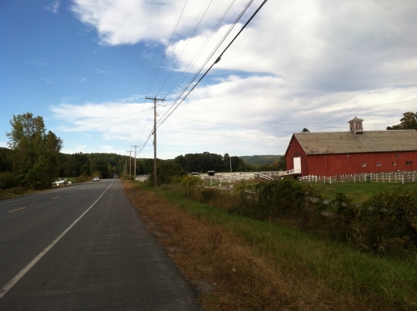
New Conservation District
In an interview at the Town Offices, Farwell told The Commons some of the revisions involved “variation in minimum lot sizes, and some of the uses are different.”
The Planning Commission also established new zoning districts.
What Farwell described as “perhaps the most striking change” is the new Conservation District.
Located in “the highest point in town” along East-West Road, where it goes over Black Mountain, this district's minimum lot size is now 10 acres, Farwell said, noting the former minimum was 2 acres. This change will place restrictions on future subdivisions.
The Residential District, which is “denser,” said Farwell, has a 1-acre minimum lot size, and “now some commercial is allowed,” such as “a corner store or a small restaurant.”
This district can be found in the area surrounding the East-West Road and Route 5 intersection, and a small patch of Route 30.
The Rural District is less dense, Farwell said, with a 5-acre minimum lot size.
In the Planning Commission's “attempt, from the Town Plan, to identify farmland and create a district,” members created the Productive Lands District, said Farwell. He said the land in this district has “similar uses” to the Rural District, and there is not much difference between the two.
“We've mapped it,” Farwell said, “but we're not really saying anything different has to happen” in the Productive Lands District.
“We had an especially hard time working out compromise between interests in farmland protection and preservation of undeveloped lands, and interests in landowner rights - particularly in the commercial district along Route 5,” Farwell wrote in his email.
At the Sept. 2 public hearing on the proposed zoning bylaw changes, a few residents spoke up with concerns the town's agricultural land might not be adequately protected from development.
Farwell's response: while some of the Route 5 corridor's zoning does allow for commercial development, what is missing is demand.
“There's not much of a market” for turning Dummerston's portion of Route 5 into something resembling Brattleboro's Putney Road, Farwell said.
He noted the properties along Route 5 are “privately owned land, not public land.”
“The landowners want to keep their options open” for possible commercial uses,” he said.
Farwell noted some land along Route 5 was taken out of the old zoning map's rural commercial district, thus preventing its use for commercial development - unless a future Planning Commission changes its zoning. A few of those parcels are in zones with conservation restrictions placed on them, so they are already precluded from development.
Recurring changes to Town Plan: a 'process'
At the public hearing, Farwell assured residents the Planning Commission will be looking at zoning again, including agricultural overlay and the Routes 5 and 30 corridors, when Dummerston updates the Town Plan next spring.
“We're required [by state law] to update the Town Plan every five years,” Farwell told The Commons.
By that, he said, “it doesn't mean [it] has to be changed, you just have to look at [it].” Farwell noted that “zoning is required to be in conformance with your Town Plan.”
“Some people think this will never happen again because it took us 40 years to create the zoning map,” Farwell said at the public hearing. But, he added, zoning bylaws are a “work in progress,” and the Planning Commission is “still making changes, even small ones.”
Farwell told the Selectboard he is applying for grant money to redo the Town Plan.
Board Chair Zeke Goodband recommended “interested townspeople join the Planning Commission” and make their opinions known.
Farwell agreed, and encouraged people “to come to the Planning Commission meetings in 2016 when we do start to update the Town Plan.”
“That's the time to get involved,” Farwell said, adding, “I hope we have great public involvement.”
The Town Plan “is a process,” said Goodband. “It's not the final word. It's a culmination of several years of work on [the part of] the Bylaw Committee, the Planning Committee, [and] input from lots of townspeople.”
Goodband said the revised Town Plan was necessary because it “clears up some of the language,” which he characterized as “contradictory.”
“It might make it easier for the Development Review Board” to do its job, Goodband added.
“I think the process we went through was not perfect, and quite comprehensive,” Farwell said.
Although Farwell told the board he is “exhausted,” he assured them, and the townspeople, that “I'm ready to do it again as soon as we update the Town Plan.”