BRATTLEBORO — There are two clear conclusions from a new state assessment of four major southeastern Vermont watersheds.
First, the basin that includes the West, Williams, Saxtons, and lower Connecticut rivers is rich with recreational opportunity and biological diversity-including two federally endangered mussel species.
But the region also has many problems, including waterway impairments related to bacteria, sedimentation, nutrient pollution, and temperature. The last problem is particularly acute, as the report notes “some of the highest number of miles of temperature impacts in the state.”
The report's 26 pages of proposed solutions may seem daunting. But officials say they're happy to have a comprehensive list from which to tackle the basin's biggest issues.
“Because we now have a plan, it really is an enabling force as far as getting projects done,” said Kim Smith, an assistant planner at the Brattleboro-based Windham Regional Commission. “We're looking forward to diving in and helping out where we can.”
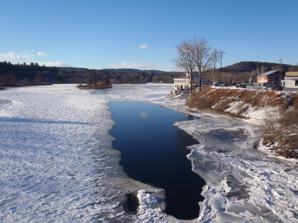
Assessing the basin is no easy task: It sprawls over almost 700 square miles, with elevations dropping more than 3,700 feet from Stratton Mountain to Brattleboro. The basin includes all or part of 29 towns.
The West River is the largest watershed in the basin, stretching 46 miles from Weston to Brattleboro and draining 423 square miles. Tributaries include the Rock River, Winhall River, Wardsboro Brook, and Ball Mountain Brook.
The new tactical basin plan (available at www.watershedmanagement.vt.gov) was released via the state Department of Environmental Conservation's Watershed Management Division, and it extolls the area's “extensive” water recreation including paddling, fishing, and ice fishing.
The report also notes “high concentrations of rare, threatened, and endangered species” in the lower Connecticut and West River Valley along with “significant natural communities” in the higher elevations, particularly in the Green Mountain National Forest. Mussels and migratory birds are highlighted, and it's noted that the region has four areas identified as “nationally important fish and wildlife habitats.”
But state officials found threats to the basin's well-being. Those are divided into five categories-atmospheric deposits resulting in fish mercury contamination and water acidification; flow alterations; channel and land erosion; thermal modification; and pathogens.
Flow alterations are blamed on water withdrawals, dams, and impoundments. Similarly, rising temperatures were attributed to impoundments and a lack of vegetation near or in waterways. Culprits behind the basin's other forms of water impairment include poor land management; stormwater and agricultural runoff; failing septic systems; and improperly maintained waste water systems.
Even longer than the list of problems, however, is the list of solutions. In releasing the basin plan, state Watershed Coordinator Marie Levesque Caduto said the document “gives us concrete projects in concrete places so we can make improvements all over the basin.”
And the report does not disappoint on that front, offering a detailed breakdown of proposed projects along with potential funding sources and partner organizations. The state's priorities for the basin include:
• Ensuring that river corridors and flooding considerations are factored into local and regional plans and zoning. The report makes a point of recalling the “astonishing intensity” of Tropical Storm Irene's flooding in 2011, and officials say the effects of that storm should serve as a guide for future planning and development.
“The new river channels and patterns, if allowed to remain, will offer some mitigation of future flood events,” the reports' authors wrote. “Future attention to building with flood resiliency in mind will also move the region toward a more sustainable co-existence with our rivers.”
• Protecting land and habitat along the Connecticut River in Brattleboro and Rockingham to preserve rare, threatened, or endangered species.
• Controlling high bacterial levels in the West River in Londonderry.
• Starting restoration projects to deal with sedimentation and stormwater impacts on the North Branch of Ball Mountain Brook and tributaries.
• Implementing a variety of restoration projects on the Williams, Saxtons, Rock, and Winhall rivers and on Ball Mountain and Wardsboro brooks.
• Performing stormwater-control projects aimed at reducing flows and sediment, with a focus on Brattleboro, Bellows Falls, and Chester along with the Stratton/Winhall resort region.
• Working with Winhall, Londonderry, Jamaica, and Wardsboro to deal with sediment and temperature impairments on the Winhall River and Wardsboro Brook.
• Prioritizing the basin's dams and assessing removal of two such structures - the Williams Dam in Londonderry and Sacketts Brook Dam in Putney.
• Studying possible restoration of three wetland areas - Upper Meadow and Herricks Cove in Rockingham, and the Retreat Meadows in Brattleboro.
• Considering reclassification of certain waterways and wetlands to require higher levels of protection. For example, the state lists three wetlands-the Athens Dome Wetland Complex, the Winhall River Headwaters wetland complex and the Eddy Brook wetlands-that might benefit from “Class 1” status. That label “merits the highest level of protection.”
The goal, according to the basin plan, is to “carry out as many of these actions as possible over the next five years.” It's hard to say how feasible that might be, but the document lists 34 potential funding sources.
Just as importantly, there's another page filled with partners including federal, state, and regional agencies; one private company (TransCanada); and nonprofits such as The Nature Conservancy, Southern Vermont Natural History Museum, and Southeastern Vermont Watershed Alliance.
Smith said local organizations like the Saxtons River Watershed Collaborative are showing how much can happen when those with an interest in the environment join together.
“This plan is very ambitious. There are a lot of projects in it,” Smith said. “But, at the same time, we're seeing a lot of really great synergies with some of the watershed groups.”
Smith also noted that Vermont's new water quality law, Act 64, will be driving many water-cleanup and pollution-prevention projects in the coming years. Under that law, “towns will have a need to address some of these issues, too,” she said.