BELLOWS FALLS — A second public discussion addressing an area-wide plan for the Island and Under the Hill districts on Aug. 12 presented four potential redevelopment scenarios for about 24 attendees, half in person at the Waypoint Center and half on Zoom.
The region includes “perceived, suspect, or known environmental impacts, including both petroleum and hazardous substances,” according to a preliminary synopsis from the Nobis Group, the environmental engineering firm working with Stevens & Associates of Brattleboro to develop a final plan, which the town calls “an important step to accessing needed funding support and attracting new development.”
Ideas suggested at a June 10 public meeting include new residential, commercial and/or industrial development; strengthening the arts scene; improving walkability; expanding information about cultural heritage; and creating fun places for strolling, eating, and more.
The consultants will continue to present alternative development scenarios that include public input as part of the ongoing study, supported by village and town governments, the Windham Regional Commission, and the U.S. Environmental Protection Agency.
According to the Windham Regional Commission website, consultants will take the community through this process to create an “implementable plan,” one that will “help the community identify the highest and best uses for properties in the study area and identify issues related to brownfield contamination and redevelopment plans for specific parcels.”
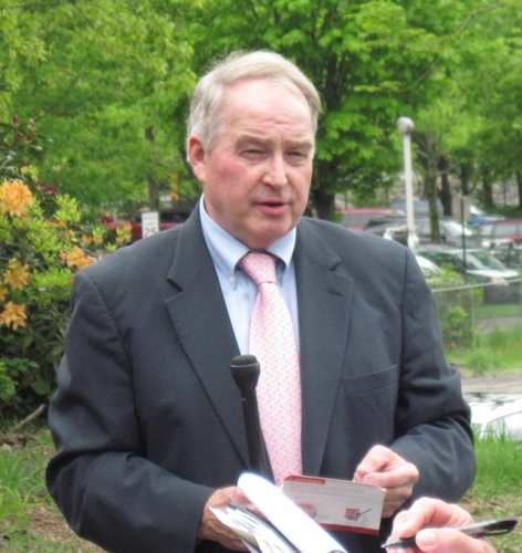
The last-minute choice to include a Zoom component after several people had inquired for it caused a bit of confusion and disgruntlement, as Gary Fox, the town's economic development director who serves as project lead, hadn't time to make all pertinent documents easily accessible to the Zoom audience when it came time for participants to identify their preferences for each plan.
Those present in person were ultimately asked to place stickers on favorite plans and aspects of each plan, and the Zoom folks did have the chance to note their preferences, and the plans are available now online for all to weigh in and register comments.
This is certainly not the first time “exploring alternative development scenarios that would make this part of town a better place to live, work, and visit” have been taken up for the historic 47-acre region, once home to a thriving paper mill and railroad town along the canal here.
Even this current planning process has been in the works for a decade. The industrial heritage of the area complicates new development, but organizers maintain that some funding sources are available to address these concerns.
An industrial history, with environmental impacts
In the early 20th century, Bellows Falls became known as “the town built by paper,” although there were other mills here from large operations with world-wide distribution, such as Vermont Farm Machine Company, and smaller grist and lumber mills.
In 1898, International Paper Co. located here and introduced the first commercially viable paper machine that used wood pulp instead of rags. By 1902, in the village of then just more than 3,000 residents, International Paper Co. employed about 4,000 people on the Island and Under the Hill in Bellows Falls.
During the mid-1900s, the decline of the old mills and the Boston & Maine Railroad left this industrial district in rough shape. There remain many large, dilapidated, contaminated properties in this section of the designated downtown.
The central business district has seen the most renovation and revitalization, with the Central Business Expansion District (CBE) to the south seeing substantial renovation. The CBE to the north has seen some and is beginning to see more substantial renovation with the Bellows Falls Garage Project.
The Island District has seen some renovation, but has not quite been able to get over the threshold for redevelopment hoped for in the many Island study reports from the 1970s, 1980s, and 2000s.
The proposed scenarios
The four scenarios presented:
• Industrial: This plan envisions “tiny houses” along the canal, a new welcome overlook, new mixed-use structures, improvement to the character of Bridge Street, and new industrial development.
• Walk, culture, restore: This plan envisions new river overlooks, a new riverfront trail, removal of some structures and restoring land, a new walking loop, new Abenaki cultural places, and a new raised pedestrian overpass.
• Mixed-use residential (with some industrial use, especially due to brownfield issues): This plan envisions a new perimeter connecting walk, some new industrial development, new mixed-use and transit-oriented residential development, a new elevated suspension bridge, and a new welcome station.
• Canal Place: This plan envisions a rail station café, tiny shops, a new restaurant/brewery and brew pub, a new amphitheater, a new canal walk with “fun lighting,” and something like elevated fire pits that can be lowered to just above the water surface for celebrations.
Parking appeared to be the primary issue for many, as did possible recontamination during any potential work of already-cleaned-up properties, now privately owned.
“I'm definitely hearing parking is important,” said landscape architect Mark Westa of Stevens & Associates.
Many in attendance appreciated the Abenaki connection, increased walkability/river access, lighting over the water, and overall recreational improvements.
Robert McBride, the founder of the Rockingham Arts and Museum Project (RAMP) who serves on numerous southern Vermont development and zoning boards, suggested fountains rather than fire pits over the canal.
“Sort of like Versailles,” he said with a smile, noting they could be solar-powered. “The exciting thing about future development or thoughts of it is to take advantage of the natural beauty and resource point of view [...] to take advantage of views along the canal not necessarily taken advantage of now and walking the property.”
Others noted that for any or all of such a plan to happen, outside investment would be needed.
“The time might be really prime for local investors to start doing small things, if it looked like there were some incentive,” said Duane Case, a member of the Rockingham Incremental Development Alliance Working Group, noting “baby steps” to think about what things really need to be done by the municipality or town government.
He said as people start to “enjoy the Island, they'll become incentivized to do something.”
Fox noted the various financing possibilities for infrastructure, streetscapes, trails, and more, including TIF, or tax increment financing, a public financing method used as a subsidy for redevelopment, infrastructure, and other community-improvement projects.
Next step: a single, long-range plan
Fox said the next step is trying to narrow the wishes of all and determine a single, long-range plan with some incremental steps - a veritable short-term plan - to get there.
That includes Nobis and Stevens & Associates working with the town and property owners to compile public input and make a final plan that will take into account the public vote and incorporate town and property owners' thoughts “because their buy-in and participation is required for the details of the implementation of recommendations.”
It will also include other professional planning aspects that do not have public participation, such as architects' work, brownfield engineers' work, economic development consultants at Stevens looking at a marketing analysis, and the “highest and best use and demand” for various redevelopment aspects.
Finally, the intention is to produce a plan that includes design drawings, brownfield costs, work and sequence recommendations, public infrastructure recommendations, all the various opportunities for funding the projects, and suggestions to be presented to the public at a forthcoming Selectboard meeting.
“We'll have to see where the voting goes,” said Westa, referring to the now-online scenarios and the request for all to weigh in on the aspects most desired for a final plan.
“This meeting is the planning process, and it's not that an expert is going away and coming up with an evolved plan,” said Fox, adding when the weigh-in period is complete, “we'll come back and have other plans.”
“The important thing is not to panic,” he said. “We're in the planning process and we're not done and you're not not going to have any parking for your business.”
Susan Hammond, Rockingham representative to the Windham Regional Commission, offered an optimistic final comment.
“We've seen these area-wide plans take off [and] it can make a difference,” she said, citing a similar project in Bennington that saw public and private funders come together to help pay for it and “clean up the sites and start some of these new ideas.”
“It can attract other funding sources, whether state or federal and private investment,” Hammond said.