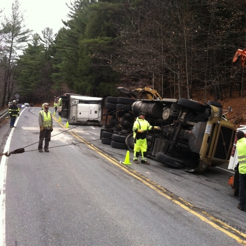
BRATTLEBORO — The 46.96 miles of Vermont Route 9 from the Chesterfield, N.H., bridge to the New York state border has been around in one form or another since the 1760s.
Route 9 - officially the Molly Stark Trail through the entirety of its length in Vermont - is part of a key east-west route between Portland, Maine and Albany, N.Y.
While the traffic on Route 9, designated a National Scenic Byway in 1995, has evolved over the centuries from slow-moving horse-drawn freight wagons to speeding trailer trucks, the route of this highway has changed little over the years - and it has been a constant source of aggravation for people who use it and the people who live along it.
That is the context behind the major construction project, in the planning process since 2018, on approximately 12.5 miles between Edward Heights in West Brattleboro and Sun and Ski Road in Wilmington.
A big project
According to a project fact sheet from the Vermont Agency of Transportation (AOT), the two-year, $28 million project “will reduce damage from potential floods at five specific locations along Vermont 9 starting at approximately mile marker 8.0 in Marlboro to mile marker 3.5 in Brattleboro.”
Improvements along this section “include armoring and constructing flood shelves along the road bank, creating access to a floodplain to reduce stream power, and realigning the river channel to improve flow through an existing bridge.”
This work will create permanent fixes for the sections of the highway that were destroyed by flash flooding during Tropical Storm Irene in 2011.
Irene caused considerable damage along Route 9, washing away several roadway segments between Marlboro and West Brattleboro. Route 9 through the heart of Wilmington also received considerable damage.
As a result, the entire 35-mile stretch between Woodford and West Brattleboro was closed for nearly three weeks.
Route 9 was among 450 miles of state highways that were damaged by the storm. It took a combination of AOT crews, private contractors, and the Vermont National Guard to reopen Route 9 and other key east-west roads in southern Vermont, including Vermont Route 103, Vermont Route 11, and U.S. Route 4.
“New gravel will be placed in some areas along the corridor to improve banking” during the repaving, according to information from the AOT shared on the Marlboro community Facebook group.
“Additional work will include the replacement and maintenance of existing guardrail runs, some culvert replacements, [and] ditching and center line rumble strip (CLRS) installations where criteria have been met,” the memo said.
“Finally, signs along the corridor will be replaced and upgraded to meet current standards set in the Manual on Uniform Traffic Control Devices (MUTCD),” the AOT continued.
According to the memo, “the finished product will be the same as Route 30 from Bondville to Route 11. Smooth as glass!”
Long slog ahead
AOT Project Manager Matthew Bogaczyk said work began last week on the project by the primary contractor, Pike Industries Inc., of Belmont, N.H.
“The contract was structured such that the contractor could only perform some of the drainage and prep work for the [pavement] reclamation taking place next year,” he wrote in an email to The Commons. “As such, I am only expecting to see some ditching, shoulder restoration, underdrain installation, and culvert replacements this year.”
AOT will start work on the roadway in the spring of 2022 and give it the first new paving job on the section in about 20 years. The focus will be on rebuilding the road surface before applying a fresh coat of asphalt.
Bogaczyk wrote that the project will also install a new left-turn lane near Marlboro Elementary School for westbound vehicles to safely turn onto South Road in Marlboro.
As recently as Sept. 2, the AOT produced a presentation about the project as part of the Route 9 Corridor Management Plan, noting that rights-of-way issues for property not already covered by such agreements could thwart plans for such a turn lane.
The presentation also noted work that will include:
• Assessment of the truck climbing lane just before the Marlboro School, and removing sight impediments there, “mainly trees,” in the current state right of way.
• Center line rumble strips near Hamilton Road, as well as potential redesign to improve visibility.
• Road slant (banking) issues along most of the paving project.
• Shoulders, where possible, which will be widened to at least 4 feet “except for one small area.” Most will be 5 feet or wider.
“I have heard that the contractor is planning to work on some of the widening needed for this installation in the [current] construction season,” he wrote.
In a public hearing in 2019, the Route 9 project was described as “one of the most complex projects” that AOT has worked on in recent years.
Part of that is due to the path of the highway. Ideally, AOT likes to create roadways with 11-foot-wide travel lanes and 4-foot-wide shoulders. Where it was possible, AOT did exactly that on sections of Route 9 in the 1990s to eliminate dangerous curves and narrow lanes of travel.
But it is impossible to build that wide a roadway on many sections of Route 9 because the road travels close to unmovable landforms, such as ledge, and to waterways, such as the Deerfield River and Whetstone Brook.
Those complexities effectively doubled the cost of the project, which AOT first estimated at $14 million in 2018. The federal government will pick up 86 percent of the tab, with state bonding covering the rest.
Drivers on Route 9 can expect construction delays when the major construction work begins next spring. AOT hopes to have everything finished by the end of the summer of 2023.
